Planning Your River Trip
• Always wear a life jacket. Personal Flotation Devices (PFDs/life jackets) are required to be worn while on rivers inside of Mammoth Cave National Park at all times. It is important that your PFD is properly fitted, and US Coast Guard approved.
• Let someone know your plan. You should always leave a float plan with family/friends and inform them of your departure and return. Do not forget to inform them when you return so an unnecessary search is not started.
• Leave alcohol at home. Alcohol is prohibited on the rivers inside Mammoth Cave National Park.
• Know the water level and weather forecast. River use is prohibited when river levels are at or exceed 20 feet on the park’s water level gauges. To find out whether conditions on the Green River are suitable to launch your canoe or kayak, visit the USGS website: https://waterdata.usgs.gov/ky/nwis/uv/?site+no=03309000&PARAmeter_cd=0065,00060
• River hazards exist, please be alert for fallen trees, submerged trees and rocks, drifting debris and swift current.
• Beware of all motorized vessels.
• The river is a dynamic system which changes constantly. Expect the unexpected; conditions can change quickly. Watch for these changes and take immediate action to reach safety.
• Do not exceed your skill level. If you are new to canoeing/kayaking, stay close to your launch area and paddle with an experienced acquaintance. Be capable of re-entering your watercraft.
• NOTE: should an emergency arise, help is NOT a phone call away. Cell phone service is limited inside Mammoth Cave National Park. Even if you are able to get a 911 call out, help can still be at least 45-90 minutes or longer away. For Non-Emergency Law Enforcement Assistance dial: (270) 597-2729.
Safety Considerations Around Green River Ferry
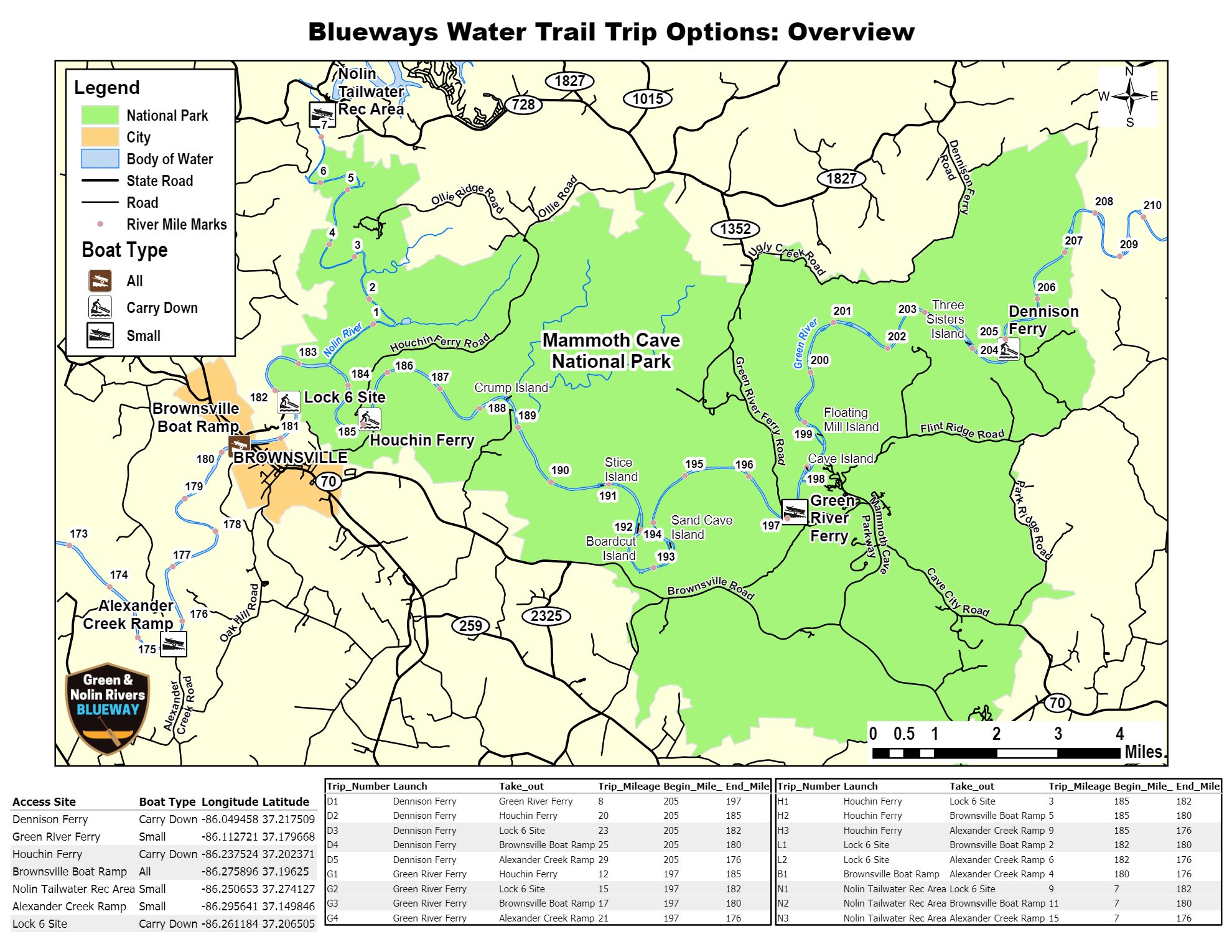
One large auto ferry operates on the Green River at River Mile 197. This vessel lacks clear visibility and the ability to stop quickly. It can easily swamp a canoe. In a mishap, the risk of being pulled u.er this vessel by the current exists. This launching and retrieving site can be quite congested. Extreme caution should be used when approaching the ferry.
• When you encounter this vessel stay back at the safest distance possible.
• Make sure that the ferry operator has made eye contact with you prior to your getting close to the ferry.
Visitors planning to paddle the Nolin River downstream of the dam can call 270-286-4511, Monday through Friday, 6:30 am — 3:00pm to find out current water releases. They can also access water releases (notated in cubic feet per second) at the following website: https://www.lrl-wc.usace.army.mil/reports/lkreport.html.
They can also check the Nolin River gage located at the Nolin Tailwater boat ramp (listed as KyRock) at: https://waterdata.usgs.gov/ky/nwis/uv?site_no=03311000
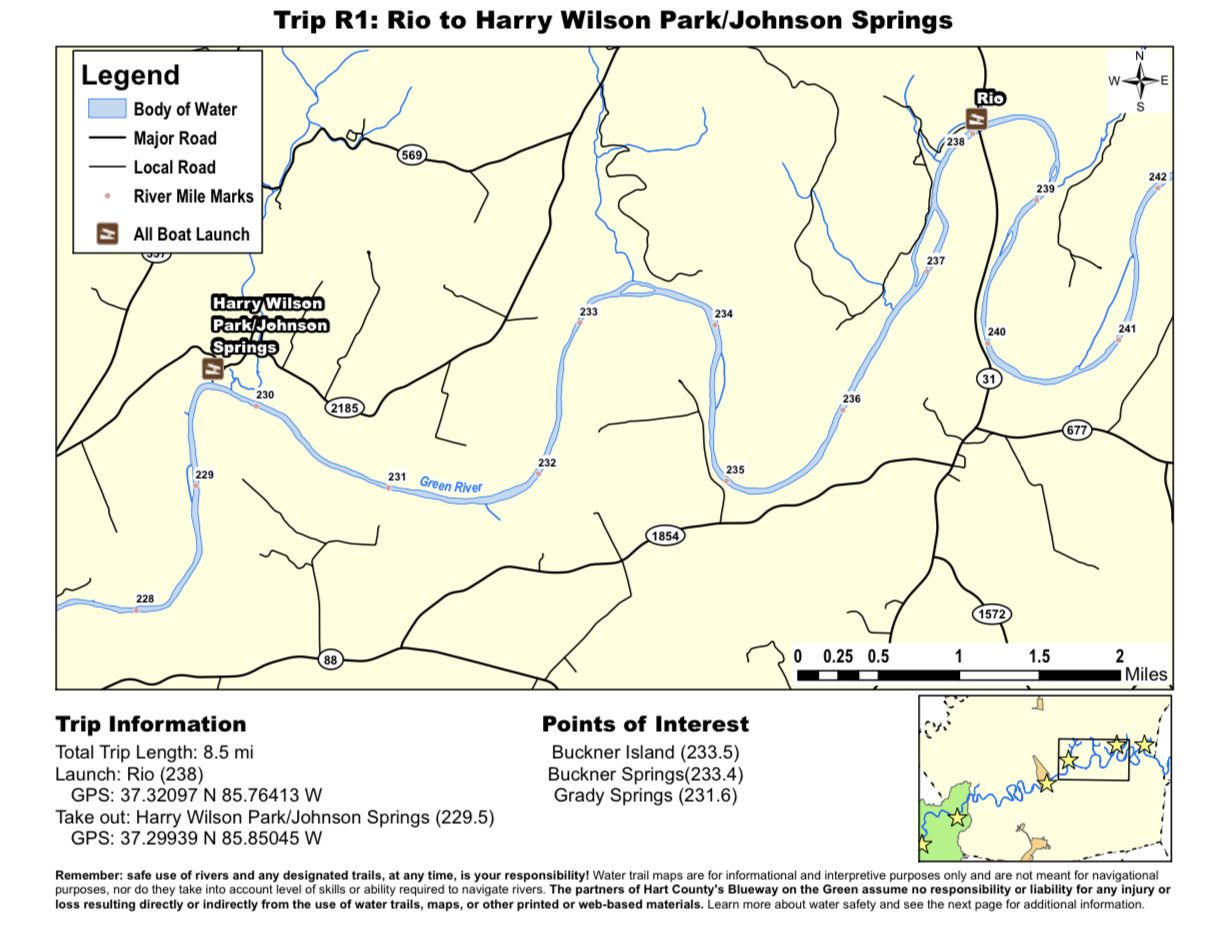
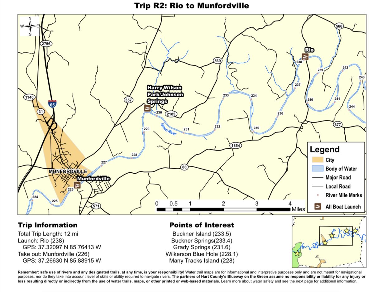
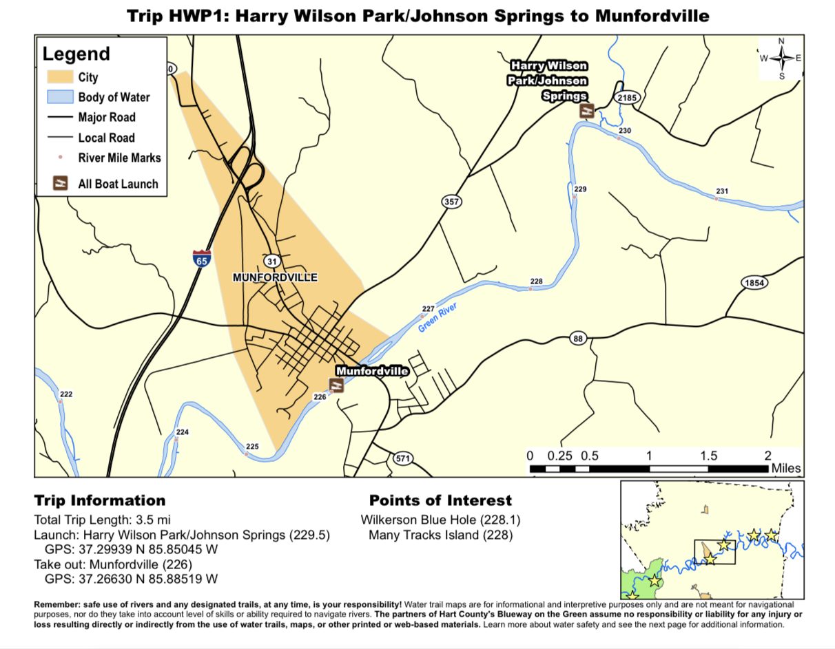
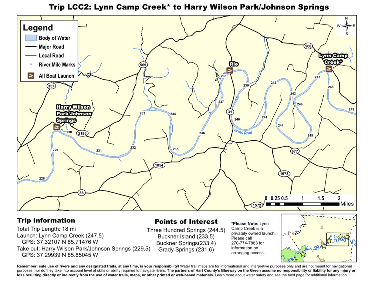
Remember: safe use of rivers and any designated trails, at any time, is your responsibility, Water trail maps are for informational and interpretive purposes only and are not meant for navigational purposes. nor do they take into account level of skills or ability required to navigate rivers. The partners of the Hart County’s Blueway on the Green assume no responsibility or liability for any injury or loss resulting directly or indirectly from the use of water trails, maps or other printed or web-based materials. Learn more about water safety.

